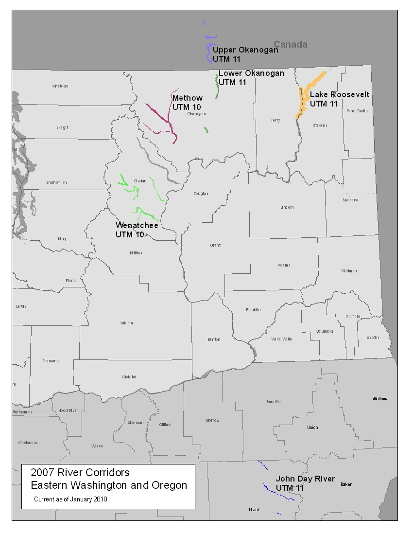
Puget Sound Lidar Consortium

Home | About Lidar | About the PSLC | Data | Uses of Lidar data | Links | Contact us


2007 Eastern Washington and Oregon River Corridor Projects


Description:
This project covers several river corridors in Eastern Washington and Eastern Oregon.  The surveys were done for the Department of Interior (DOI).  DOI requested that the data be in the UTM coordinate system.  Therefore the projects are in two coordinate systems, UTM 10 and UTM 11, depending on the location of the project. The projects cover sections of the John Day River, Lower and Upper Okanogan Rivers, Methow River, Wenatchee River and Lake RooseveltSee Map of Projects.

The DEM grid cell size is 1 meter. The elevation units are in meters.  Data is in Universal Transverse Mercator (UTM) Zone 10/11, in the NAD83/NAVD88 datum
(Geoid 03).

Back to Data by Projects

Reference Information:
This information is provided to be used in conjuction with the LiDAR datasets.

Map of Project (JPEG)
Project Reports and Trajectory Files
Metadata - see raster files
Project Area
(Shapefile)
Quarter Quad Index files (Shapefile)
ASCII Tile Index files - UTM 10 (Shapefile)
ASCII Tile Index files - UTM 11 (Shapefile)
Frequently Asked Questions
      
Data:
The raster data is available in either USGS quarter quads and as a Mosaic.  The elevation data in quarter quads is in the
ArcInterchange .e00 format.  The hillshade images in quarter quad are in georeference TIFF format.  The point data is available in ASCII text format.  Point data is only available by tile.  For this project the tiles are 1/64 section of a USGS 7.5" Quad.  For details on the subdivisions of this data see the Index shapefiles in the Reference Information section above.

Raster Data by USGS Quarter Quad
3 ft raster resolution
Individual Files DEM Index Map Topographic Image
Index Map
UTM 10 NAD83
Methow and Wenatchee Rivers.


Bare Earth
Top Surface


UTM 11 NAD83
John Day River, Lake Roosevelt, Okanogan River.


Bare Earth 
Top Surface


Bare Earth Point ASCII files
Use the tile index files provided under the reference information section above to locate the tiles needed.  Also page xx from the project report has further explanation of the tiling system for these projects.

PSLC2007
John Day River
Lake Roosevelt
Methow
Lower Okanogan River
Upper Okanogan River
Wenatchee

All-Returns ASCII files
Use the tile index files provided under the reference information section above to locate the tiles needed.

PSLC2007
John Day River
Lake Roosevelt
Methow
Lower Okanogan River
Upper Okanogan River
Wenatchee


Back to Data by Projects


Update Policy 
As we approve data from the contractor they are posted here. Areas within many of the bare-earth DEMs can be improved by further processing of the all-return point data to better isolate bare-earth points. As we make these improvements we will upgrade the bare-earth DEMs and derivative images posted here.

Technical Assistance
If you have difficulty loading the data files into your software, cannot easily transfer large files via the Internet, or would like advice on the uses and limitations of these data, please reference our frequently asked questions.  If you can't find what you need here contact us.

This page maintained by PSLC webmaster