Puget Sound Lidar Consortium

Home | About Lidar | About the PSLC | Data | Uses of Lidar data | Links | Contact us


2008-2009 Lewis County LiDAR Project


Description:
This dataset is a partial coverage of Eastern Lewis County. It includes parts of Hwy 7, 12, and 706 as well as parts of the Cowlitz and Nisqually Rivers. Coverage of Lewis County is divided between two years: 2008 and 2009. Data from 2008 encompasses just the northeastern section of the study area while 2009 covers the remainder of the study area (see maps below).

Point files for 2009 are distinguished between two datasets -- a general dataset for Lewis County and one labeled "NPS Rainier Only" as part of the National Park Service study area (see map below). This is to eliminate complications arising from the presence of identicial flightline numbers between datasets as a result of multiple flight missions. Elevation grids however are presented seamless by complete grids along this boundary.  Individual DEM grids are presented at a three foot resolution while mosaics from the file geodatabases have a six foot resolution. Projection is in Washington State Plane South Coordinate System FIPS 4602, with elevation units in feet, in the NAD83(HARN)/NAVD88 (Geoid03 datum).

Reference Information:
This information is provided to be used in conjuction with the LiDAR datasets.

Project Map (JPEG)
Project Report
Metadata
Quarter Quad Index (Shapefile)
ASCII and LAS Tile Index (Shapefile)
Trajectory Files
Frequently Asked Questions
      
Data:

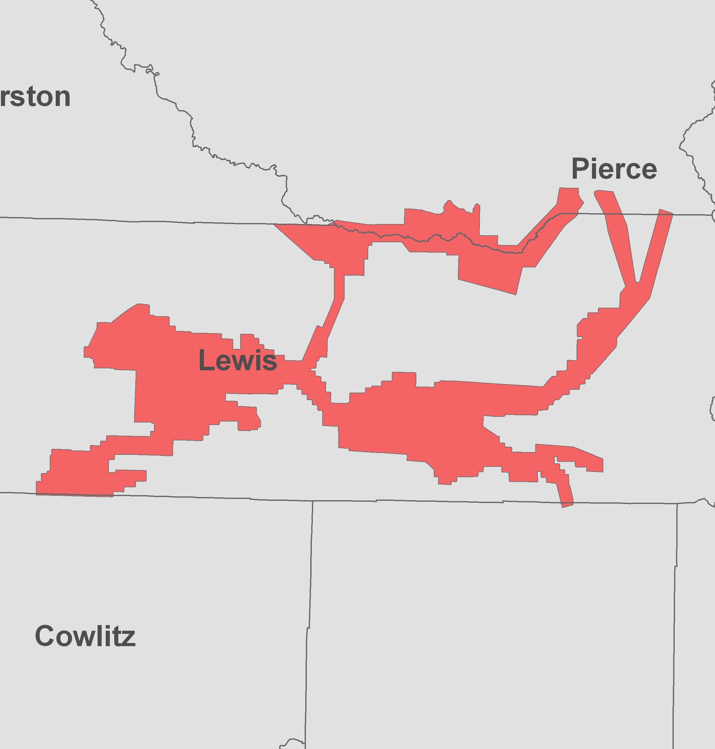
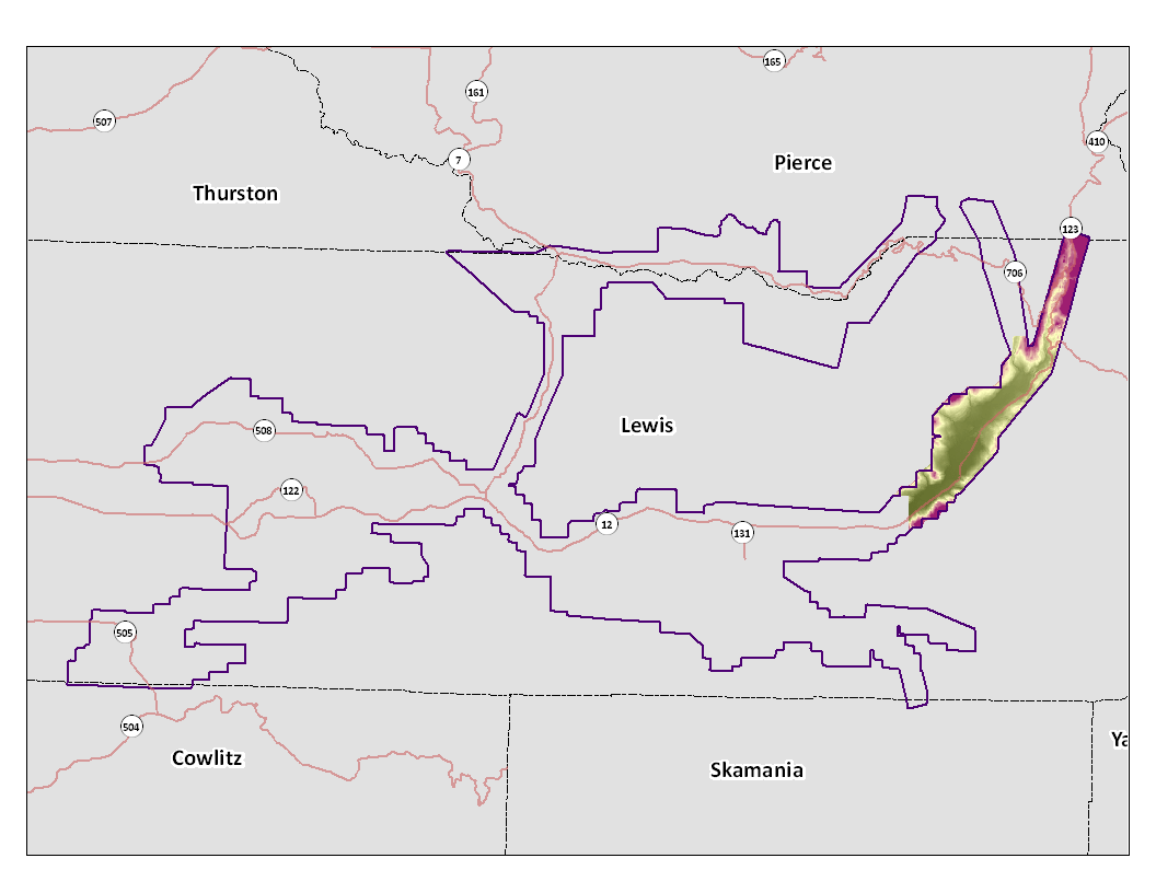
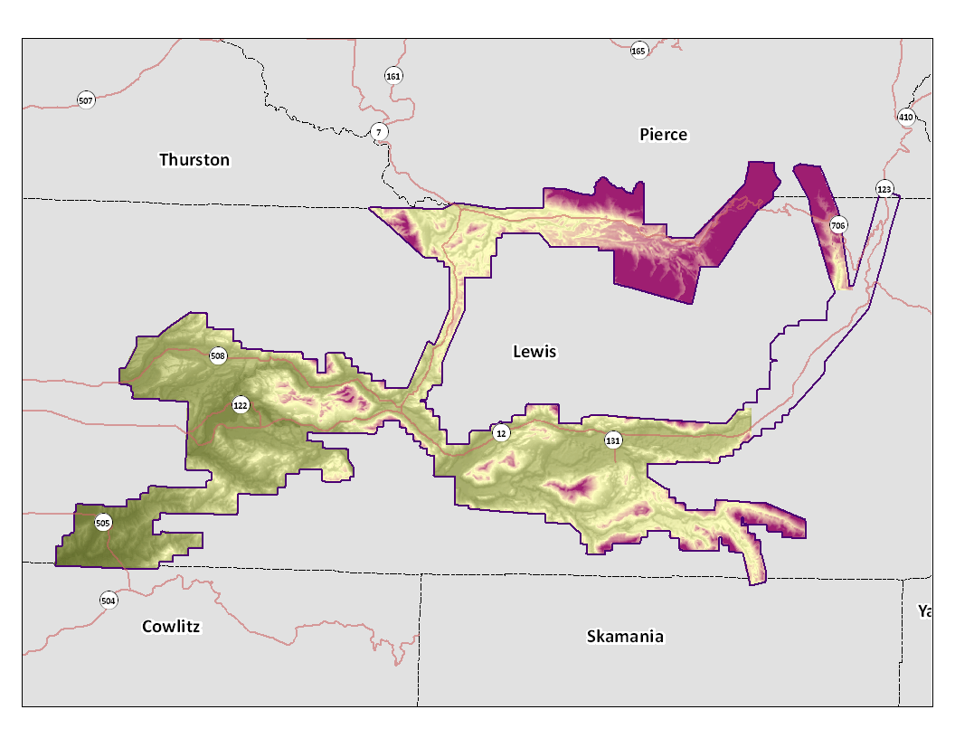
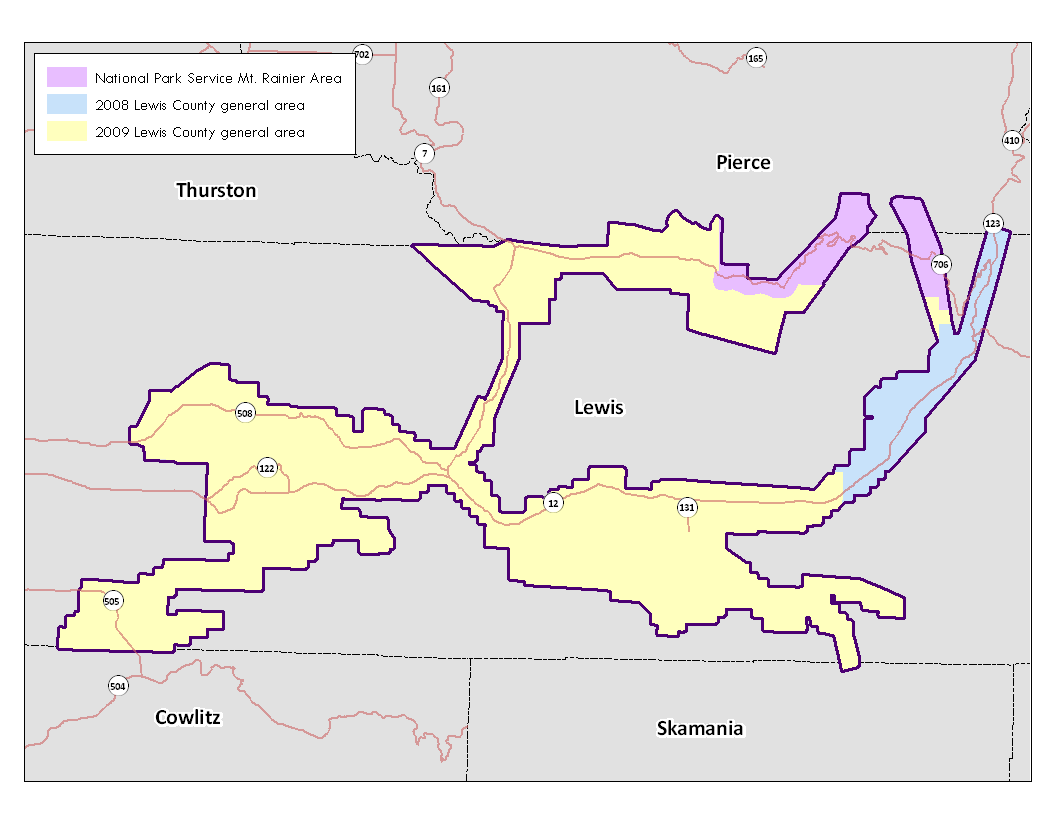
The raster data is available in either USGS quarter quads and as a Mosaic.  The elevation data in quarter quads is in the ArcInterchange .e00 format.  The hillshade images in quarter quad are in georeference TIFF format.  The raster elevation data is also available as a mosaic ArcGIS 9.x file Geodatabase.  The file Geodatabase includes raster datasets for the bare earth and the top surface. The point data is available in ASCII text format.  Point data is only available by tile.  A tile is a 1/25 section of a USGS quarter quad, except for a small number of projects that have a different tiling system.  For details on the subdivisions of this data see the Index shapefiles in the Reference Information section above.

LAS format is available upon request; please contact PSRC.


Data by USGS Quarter Quad/Tiles Individual Files DEM Index Map Topographic Image
Index Map
Bare Earth - 3ft raster resolution
list
map
map
Top Surface - 3ft raster resolution list
map
map


2008
map


Bare Earth Point ASCII files list


All-Returns ASCII files list


2009
map


Bare Earth Point ASCII files list


All-Returns ASCII files list


LAS
list


(NPS Rainier Area Only)
map


Bare Earth Point ASCII files list


All-Returns ASCII files list


Mosaic Data


File Geodatabase Mosaic -- Bare Earth 6ft raster resolution
gdb


File Geodatabase Mosaic -- Top Surface 6ft raster resolution
gdb


Update Policy
As we approve data from the contractor they are posted here. Areas within many of the bare-earth DEMs can be improved by further processing of the all-return point data to better isolate bare-earth points. As we make these improvements we will upgrade the bare-earth DEMs and derivative images posted here.

Technical Assistance
If you have difficulty loading the data files into your software, cannot easily transfer large files via the Internet, or would like advice on the uses and limitations of these data, please reference our
frequently asked questions.  If you can't find what you  need here contact us.

This page is maintained by PSLC webmaster .